Summary: A circular walk from Torness on a mixture of minor roads and tracks, including a stretch of the old General Wade Military Road. The route passes Charleston, Carnoch and the farms of Balnabeeran and Leadclune. Enjoy views over Loch an Ordain and Loch a' Bhodaich.
Distance & Grade: 9.7km. Moderate.
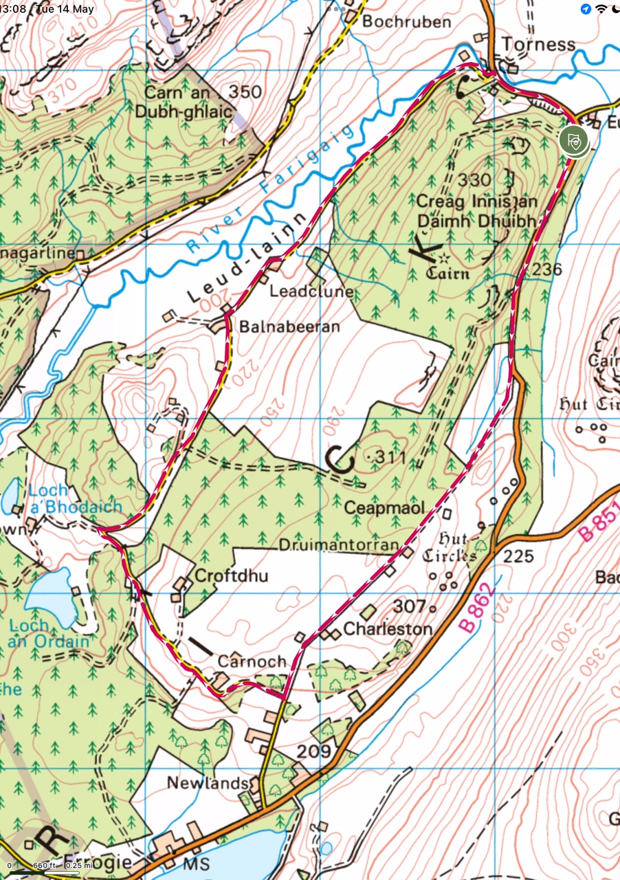 Description: Park at the end of the forestry track on the B862 south of Torness. From here, head south along the B862 (towards Errogie) for approx 800m until the road begins to bend to the left. You will see a gate on the right hand side of the road, marked by a blue 'trail of the seven lochs' sign.
Go through this gate and follow the track, which is an old Wade road. Please be aware that this can be a little wet under foot for the first few metres, but quickly becomes better as you head up the hill. You will pass some ruined cottages as the track flattens out again and will soon reach another gate where the track becomes better quality. On your left at this point there is a holiday house. Go through the gate and follow the track to the end, where you join the unclassified road to Carnoch and Croftdhu.
Turn right and follow this road for approx 1.6km until you reach the top of the hill and the road takes a sharp bend to the right. Pause here to take in the views over Loch an Ordain and Loch a' Bhodaich and the mountains to the north west. Continue on this road, taking the tight bend to the right, passing the farms of Balnabeeran and Leadclune, heading towards Torness.
As you approach Torness, keep an eye out for the waterfall on the left hand side of the road. When you reach the junction at Torness, turn right and follow the road until you reach the forestry track and the start of the walk. Please walk carefully on this stretch as the road widens and narrows.